Hull

Kingston-upon-Hull, a port, is situated at the confluence of the river Hull and the Humber estuary flowing into the North Sea.
Hull evolved from its mediaeval role as a trading city and a military base: in the Middle Ages, its wealth allowed some of the merchants such as the de la Poles to act as money-lenders to the kings; the kings redesigned the Old Town as a planned borough - the pattern is still visible in the grid of streets - encircling it with ramparts to use it as support for military expeditions in the North.
In Georgian Hull, the mediaeval layout remained with a changed role, and it shows through: the walls were destroyed and those to the North and West were replaced by docks.
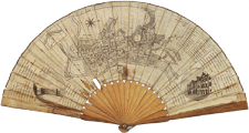
As may be seen on the map of Georgian Hull obtained by rolling over the map above, it acquired a major dock on the site of the Northern wall, ’New Dock’ (1774-78) later called ’Old Dock’ (now covered), accessed from the river Hull, both to have a loading area independent from the tide, and to make customs checking easier. It then acquired later docks on the site of the Western walls (still in existence as marinas), Humber Dock opening into the Humber (1809) and Junction Dock (1829) connecting it with the first dock.
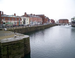
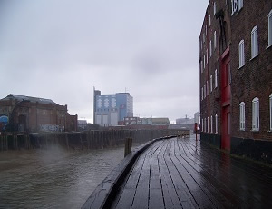
- The Junction Dock nowadays
- [click on the picture to enlarge it]

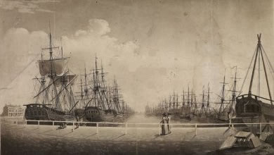
- The Old Dock (engraving)
- [click on the picture to enlarge it]

Hull had long exported wool, cloth, Yorkshire textile, to the Low Countries and the Baltic; in the late 18th century, being linked by the River Aire - an affluent of the Humber - to the canal network, it exported manufactured goods from Yorkshire and also from the Midlands and Lancashire.
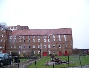
It imported timber and iron from the Baltic; from Holland it imported exotic goods, pantiles as ballast, and Delft tiles. Its trading links with Holland appear in the career of the Dutch-born Joseph Pease, promoter of oil-seed crushing and founder of Hull’s first bank (1754), whose warehouses on the river were built 1745-60.
In the late 18th century, Hull became the home port of numerous whalers sailing towards the North Atlantic.
See the Maritime Museum.
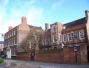
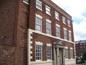
It had maritime institutions: Trinity House in the old town - an institution in charge of the interests of the maritime community-, the Pilot House on Humber Dock, the Dock Office near the entrance of the Old Dock, and inns and banks for the merchants in the old city in streets such as Whitefriars.

- Pilot House (1819)
- [click on the picture to enlarge it]
- The Pease warehouse: the river-facing side (to the right of the photo, view downstream)
- [click on the picture to enlarge it]

- The Pease warehouse: the façade on High Street
- [click on the picture to enlarge it]


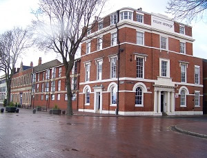
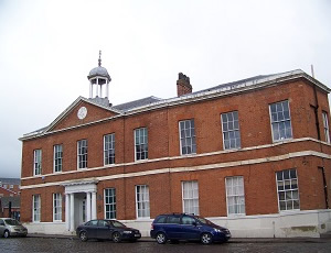
- The Dock Office (1820)
- [click on the picture to enlarge it]
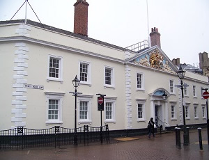
- Trinity House, the entrance with a pediment showing Neptune and Britannia (1758)
- [click on the picture to enlarge it]

- Neptune Inn in Whitefriars (1794) - a development belonging to Trinity House.
- [click on the picture to enlarge it]

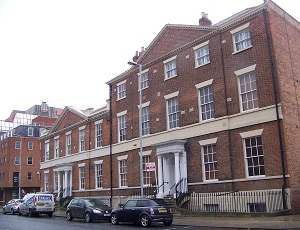
The High Street is parallel to the river which marks the Eastern boundary, so that the merchants’ houses have their façades on the street while having their backs opening directly on the river and the warehouses through their ’staithes’ (wharfs).
Some date from the 17th century, such as the one built by a merchant who had learnt trade practices in Holland and followed the Dutch architectural style; it was later adapted to Georgian taste, and was the childhood home of Wilberforce (1759-1833), from a Hull merchant family, who became an MP campaigning against the slave trade of the Atlantic ports in the 1790s till the 1807 abolition.
With the opening of the dock, a new area developed to the North, with merchants’ houses in the Northern part of High Street, such as Blaydes House, the home of the shipbuilder Benjamin Blaydes - the house has a window on top to watch the ships. New streets were also built: Parliament Street to link the old town centre to the new dock, and Charlotte Street parallel to the dock.
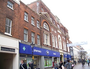
- High Street
- High Street: Georgian merchants’ houses (left) and Wilberforce House (now a museum on his life and times); the river is at the back, as shown on the map of Georgian Hull above.
[click on the picture to enlarge it]

- High Street (North): Blaydes House
- [click on the picture to enlarge it]

- Georgian houses in Charlotte St.
- [click on the picture to enlarge it]
