
Rocque’s map of London (1746)
Rocque’s map of London
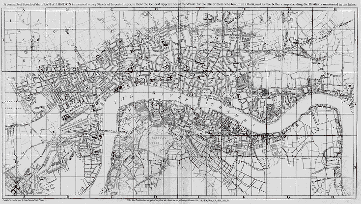
- Rocque’s map of London
- [click on the picture to enlarge it]

The ’proposals’ for John Rocque’s map asserted that the survey was done:
“by Trigonometrical and other Observations from the Tops of Steeples...; by taking the Angles at the Corners of Streets, &c with Proper Instruments, and measuring Distances by the Chain”
The map measures six and a half feet by thirteen; the scale is of 200 feet to the inch.
Key to Rocque’s map
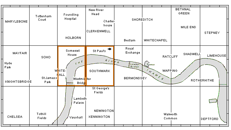
Rocque’s map was subdivided into 24 sections. To zoom on an enlarged map of any section, click on it. The brown rectangles mark the colour maps for the central sections. When coming to the key map from one of the enlarged sections, its position will be indicated on the key map by a coloured square