
Map of Bath: 1694
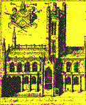


Map of Bath by Joseph Gilmore, a Bristol mathematician (1694). The vignettes around the map show the main monuments identified in the legends of the insets: the abbey, the baths, the main houses and inns.
In the late 17th century, Bath had kept its mediaeval aspect and its walls with four gates: Northgate, Southgate, Westgate et Eastgate. The abbey church towered over the small city, close to the hot water baths. The woollen trade and the weaving craft were no longer the population’s main livelihood. Besides bathing, the practice of “taking the waters” was developing. The margin of Gilmore’s map shows large inns and gabled houses where the visitors lodged.