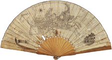
Edinburgh - 1829
- Edinburgh - 1829
![]()
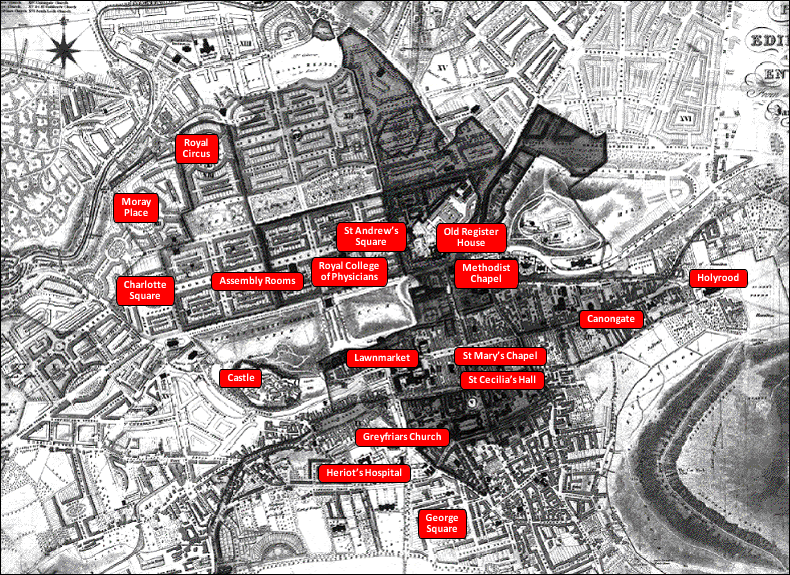
- Assembly Rooms ,
- Canongate ,
- Castle ,
- Charlotte Square ,
- George Square ,
- Greyfriars Church ,
- Heriot's Hospital ,
- Holyrood ,
- Lawnmarket ,
- Methodist Chapel ,
- Moray Place ,
- Old Register House ,
- Royal Circus ,
- Royal College of Physicians ,
- St Andrew's Square ,
- St Cecilia's Hall ,
- St Mary's Chapel ,
- The New Town (late 18th c.) ,
- The Old Town ,
- The Second New Town (early 19th c.) , )
This map shows, to the North of the Old Town (with the Castle in the centre and the Royal Mile leading to Holyrood House to the right), the New Town separated from it by gardens on the site of the drained Loch Nor.

The late eighteenth-century ‘First’ New Town designed by James Craig appears with its chequerboard plan, having a main West-East axis lined with houses on both sides ( ‘ George Street ‘ after the king’s name, which was also borne by the Lord Provost George Drummond and by England’s patron saint) leading from a square at its West end (‘Charlotte Square‘ in honour of the Queen) to its counterpart at the East end (‘St Andrew’s Square’ after Scotland’s patron saint). The West-East thoroughfares parallel to George Street, to the South and to the North, both open on to gardens towards their outer side : to the South Princes Street (in honour of the Princes, opening on to gardens separating the New Town from the Old), and to the North Queen Street (in honour of the Queen). They are crossed by North-South perpendicular streets, for instance Hanover Street in honour of the reigning dynasty; and parallel to the chief West-East streets are smaller service backstreets (Thistle Street for Scotland’s heraldic flower, and Rose Street for England’s).
Further to the North of Queen Street Gardens stands the ‘Second New Town‘ dating from the early 19th century.